Research use cases for Puhti#
Check out what others have achieved using CSC supercomputers:
Some interesting use cases from CSC seminars#
Jon Atherton, UH: Optical sensing and 4D modelling of plant ecophysiological traits#
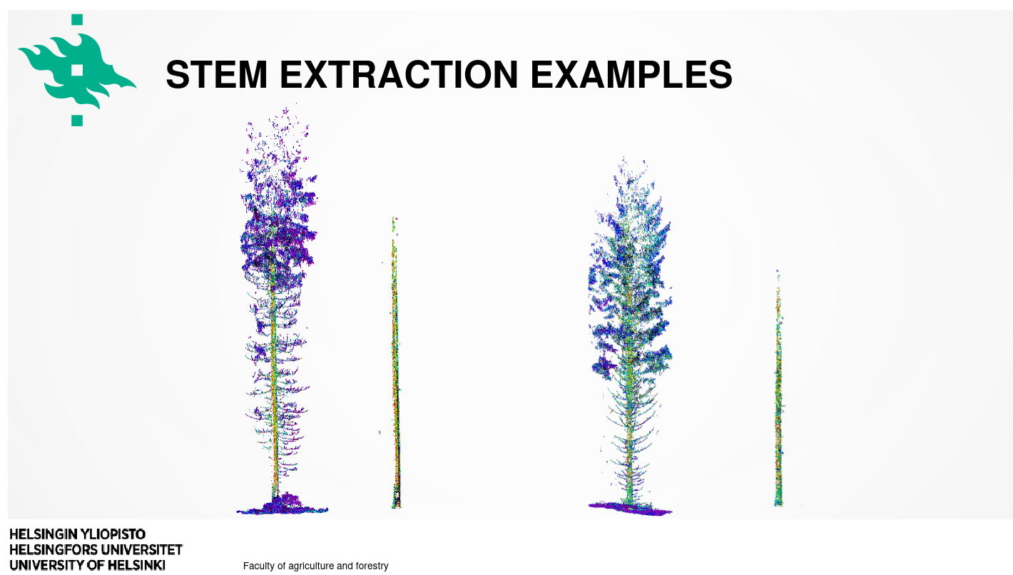
Jiri Pyörälä, UH, NLS/FGI: Experiences with PCLpy on Puhti#
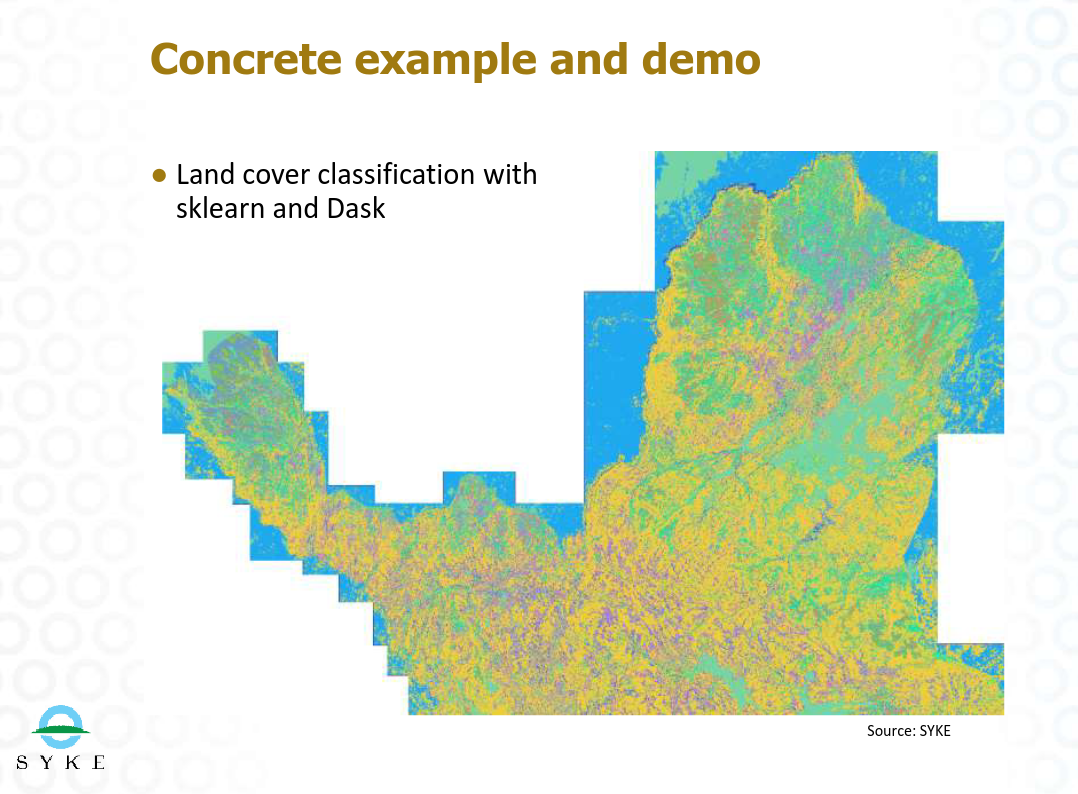
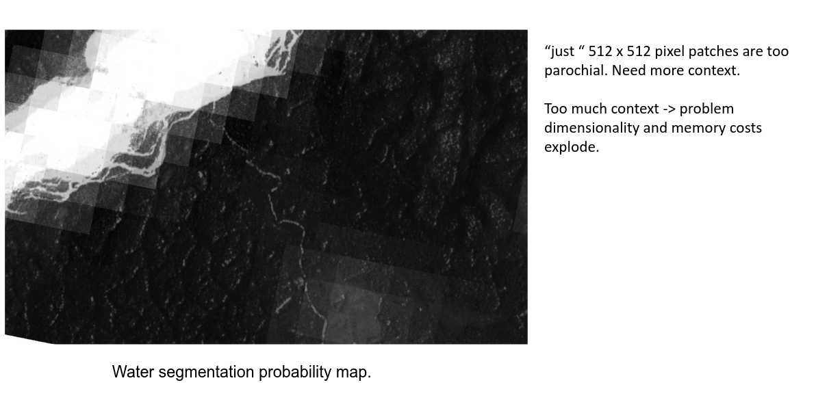
Mikko Impiö, SYKE: Modern machine learning for land cover classification#
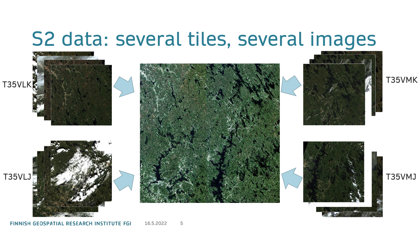
Arttu Kivimäki, FGI/NLS: Mosaicking Sentinel-2 data in Puhti#
Tapio Friberg, ICEYE: LUMI usecase#
You can find more use case presentations from CSC: geocomputing seminars page.
Some publications from Finland that used Puhti#
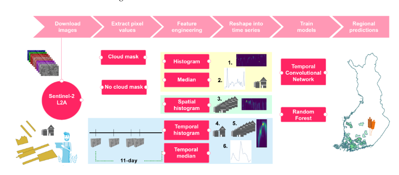
Maria Yli-Heikkilä et al, LUKE: Scalable Crop Yield Prediction with Sentinel-2 Time Series and Temporal Convolutional Network#
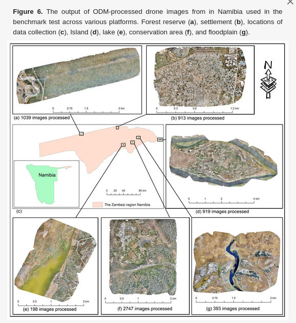
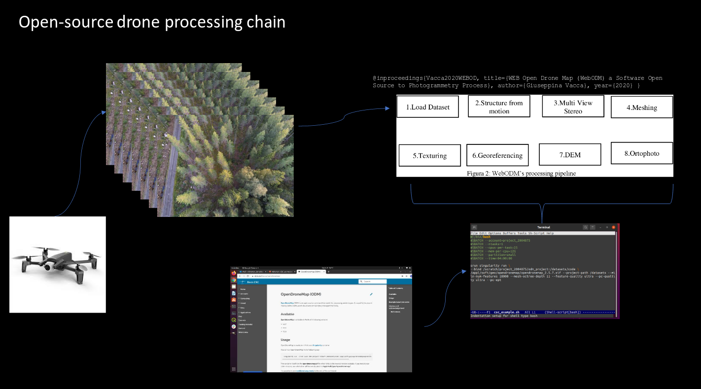
Gbagir et al, UEF: OpenDroneMap: Multi-Platform Performance Analysis#

Eetu Jutila Masters thesis, Aalto: Land cover change detection using Sentinel-1 satellite images#
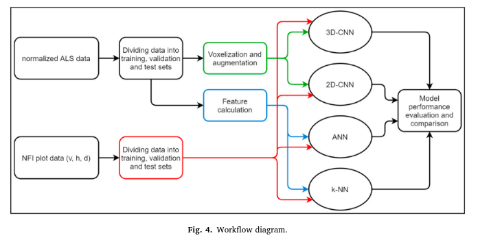
Andras Balazs et al, LUKE:Comparison of neural networks and k-nearest neighbors methods in forest stand variable estimation using airborne laser data#
Samantha Wittke et al, FGI/Aalto EODIE - Earth Observation Data Information Extractor#
Know more? -> Please let us know :)